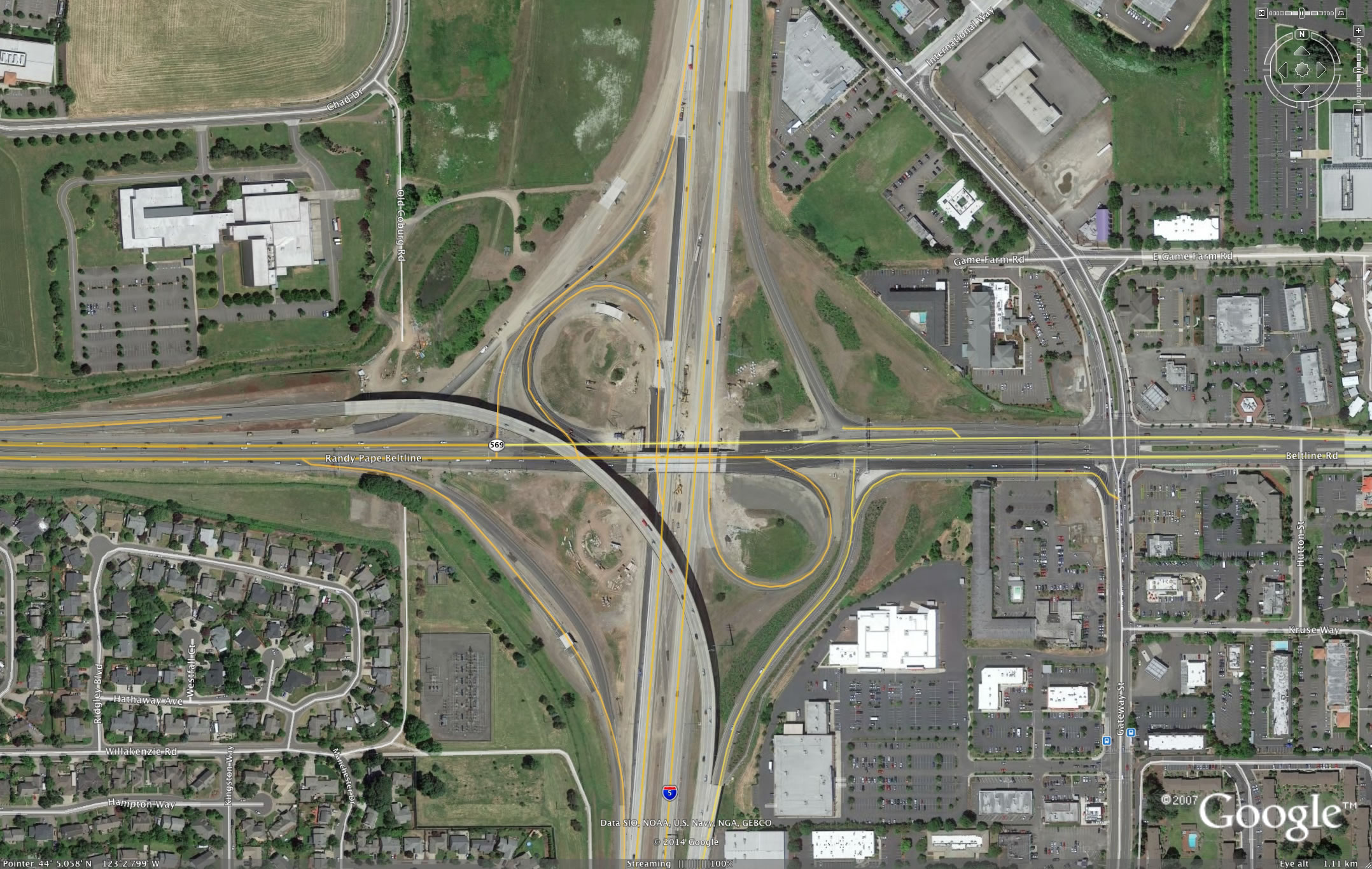
Gateway (I-5 Beltline) interchange
"low build" alternative would have saved $100 million
quarter billion spent for "Californication" - next up, widening Beltline across river
originally prepared in 2002
Summary
The I-5 / Beltline project is the backbone of the effort to relocate downtown Eugene and Springfield to the "Gateway" area, part of the on-going "Californication" of the Willamette valley. A cheaper, less ugly alternative of "collector - distributor" (local/through) lanes, Bus Rapid Transit and LUTRAQ type land use shifts [Land Use, Transportation, Air Quality] to support compact urban design in the Gateway / Coburg Road area would address the safety problems.
 The most common complaint at the June 5, 2002 public hearing was that
interchange safety issues should be separated from the project’s
massive impacts on the Gateway commercial district. The EA needs to be
rewritten as an Environmental Impact Statement (due to the considerable
socioeconomic impacts, including induced growth facilitated by freeway
expansion upon agricultural soils and the potential future expansion of
the Urban Growth Boundary northward along I-5 to the river. This EIS should
include a C-D / BRT / LUTRAQ alternative, which would solve the problem
of separating safety concerns from capacity problems in a way that had
"legal sufficiency" regarding "independent utility"
and "segmentation." This alternative would meet the EA's
purpose and need.
The most common complaint at the June 5, 2002 public hearing was that
interchange safety issues should be separated from the project’s
massive impacts on the Gateway commercial district. The EA needs to be
rewritten as an Environmental Impact Statement (due to the considerable
socioeconomic impacts, including induced growth facilitated by freeway
expansion upon agricultural soils and the potential future expansion of
the Urban Growth Boundary northward along I-5 to the river. This EIS should
include a C-D / BRT / LUTRAQ alternative, which would solve the problem
of separating safety concerns from capacity problems in a way that had
"legal sufficiency" regarding "independent utility"
and "segmentation." This alternative would meet the EA's
purpose and need.
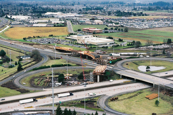
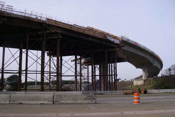 This project would reconstruct the existing interchange into a giant
Los Angeles style spaghetti bowl. Officially budgeted at $53 million in
the "TransPlan" (the region’s highway budget), the current
estimate ranges from $104 million to $122 million.
This project would reconstruct the existing interchange into a giant
Los Angeles style spaghetti bowl. Officially budgeted at $53 million in
the "TransPlan" (the region’s highway budget), the current
estimate ranges from $104 million to $122 million.
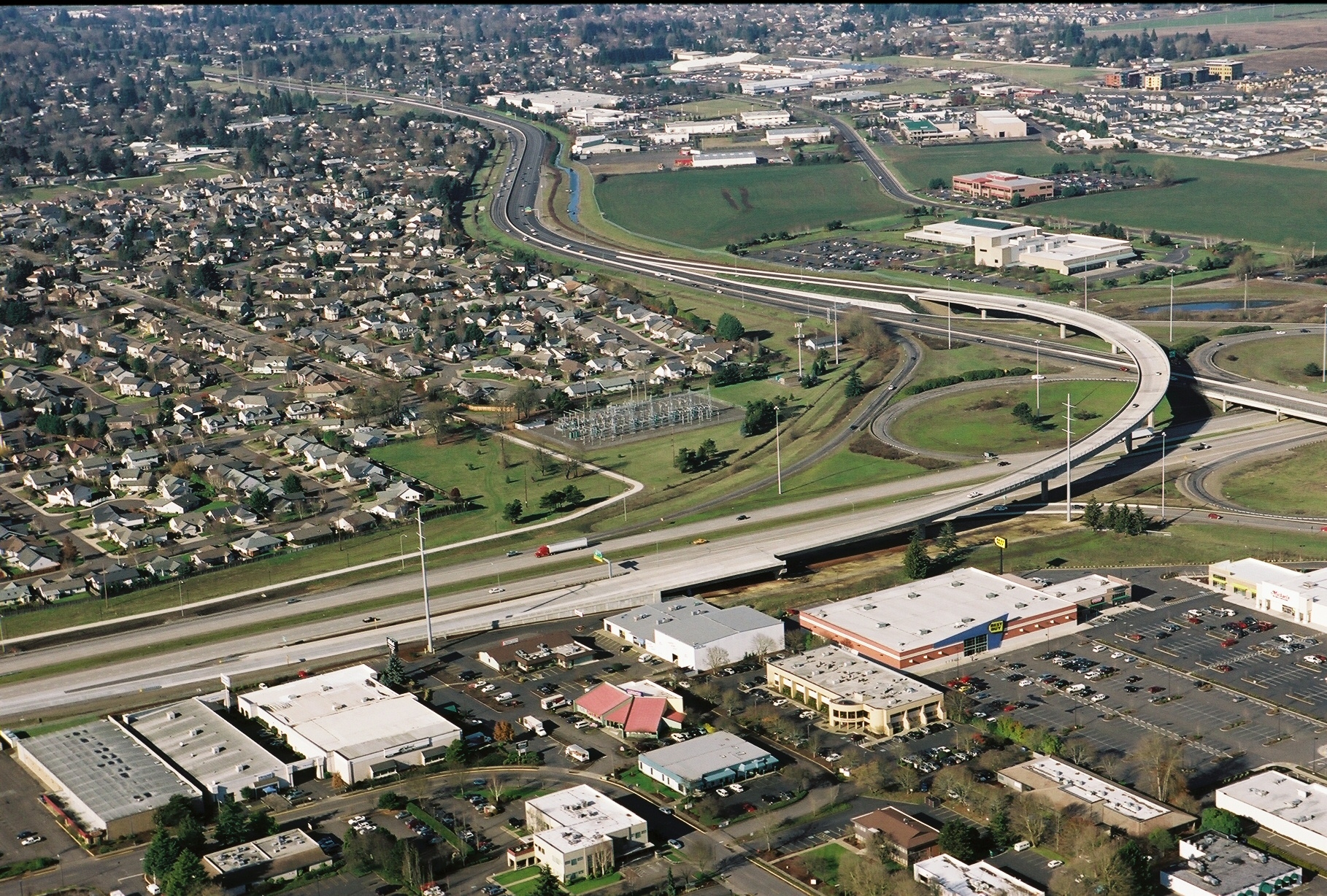
The Gateway Spaghetti Bowl would widen Beltline to 10 lanes west of I-5 (including ramps), one of the widest highways in Oregon. I-5 would also be widened to eight lanes between Beltline and I-105, which would require the demolition and reconstruction of the Harlow Road bridge over the freeway (there is not room for the extra southbound lanes underneath it). The Beltline overpass of I-5 would also need to be rebuilt to accommodate the proposed interchange design. Neither bridge reconstruction appears to be factored into the project’s cost. The EIS should provide an itemized list of construction costs for each segment of the project.
Beltline would have a much wider footprint west of I-5, requiring eminent domain condemnation of the Register-Guard's property between their parking lot and the current property line (on the south side - the parking lot and building would not be in the path). Several homes on the south side of Beltline might need to sell some of their backyards, according to figure 4-3 in the Environmental Assessment, and the reconstruction of Harlow Road over I-5 would probably force condemnation of a few homes on the west side of the interstate.
This boondoggle is a key part of the long-term effort to relocate downtown Eugene and Springfield to the Coburg Road and Gateway areas. However, a major component of the relocation - the new Peace Wealth hospital site on the McKenzie River floodplain - is not yet part of this highway plan. Once the hospital discloses its plans, even more highway construction would be planned, at even greater cost. While it is true that final design plans have not been revealed, NEPA requires environmental analysis to include discussion of projects that are reasonably forseeable. In contrast, the EA did not even mention the hospital plans, let alone begin preliminary analysis of the hospital (and associated facilities) impact on Springfield traffic patterns. This omission makes the entire EA invalid.
This project would be more appropriate for southern California than Oregon. A much cheaper alternative could be implemented, borrowing from Portland’s "Land Use, Transportation, Air Quality" solution (which substituted land use shifts and improved public transportation for the "Western Bypass").
A LUTRAQ solution for Gateway could include fixing the "merge / weave" problems at the cloverleaf with "collector - distributor" lanes to separate interchange from through traffic Northbound I-5 already has a c/d lane, and the Environmental Assessment states that it had one-third the number of accidents of the southbound I-5 segment between 1994 and 1998. This could be done for much less money than the EA proposed alternative, which would make I-5 and Beltline the widest highways in Oregon, larger than anything I've seen in Portland.
A second component would be taking the proposed Bus Rapid Transit system seriously as a way to cope with congestion, rather than as a token afterthought. The EA has TWO PARAGRAPHS that mentions BRT (pp. 2-5 & 3-27), and ignores any consideration of using BRT to reduce traffic congestion or transit oriented development to utilize BRT. The region is likely to get money for the BRT or the now-doubled-in-cost I-5 / Beltline interchange, and we must choose as a region which project is more likely to be needed in 2025, after the peak of world oil produtcion. BRT is planned to make a loop from downtown Springfield to Gateway to Coburg Road to downtown Eugene – but ODOT’s plans for the area barely mention it. Making BRT function well would require addressing poor land use design in north Eugene and Springfield that makes any transportation facility - highway or transit - unable to address congestion.
A third suggestion is to contract the Urban Growth Boundary to prevent traffic congestion and preserve farmland along the McKenzie River. There is a lot of farmland slated for what is euphemistically called "development" north of Beltline on both sides of I-5. If these plans are built, Beltline, Coburg, and Gateway will be snarled beyond repair. Last year, Symantec clearcut a filbert orchard for its new facility, a building now being mothballed as the company has decided to outsource its operations to a subcontractor (which will be located back in downtown Eugene). Figures 3-8 and 3-10 in the EA show that the current land use plans seek to pave all of the remaining farmland inside the UGB, paving over prime soils on both sides of I-5. (It’s not easy to grow food on poor quality clay soils on the hillsides, something that planners should learn before approving more soil destruction.) Perhaps Springfield will rename its "Filbert Festival" the "Peace Health Pavement" festival. If Eugene and Springfield focused on downtown revitalization at a serious level, this sprawl could be prevented - and there would not be any "need" for the Los Angeles style Spaghetti Bowl.
Ultimately, if the farmland is paved over north of Beltline inside the UGB, there would be immense pressure to expand the UGB all the way north to the McKenzie River (riverfront speculative development can be very profitable, if the global economy holds together that long), including a new I-5 interchange between Beltline and the McKenzie River (there is enough room to add a new, modest sized interchange outside the current UGB, which would reduce the pressure at Beltline/Coburg Road - but there is no money for any of this).