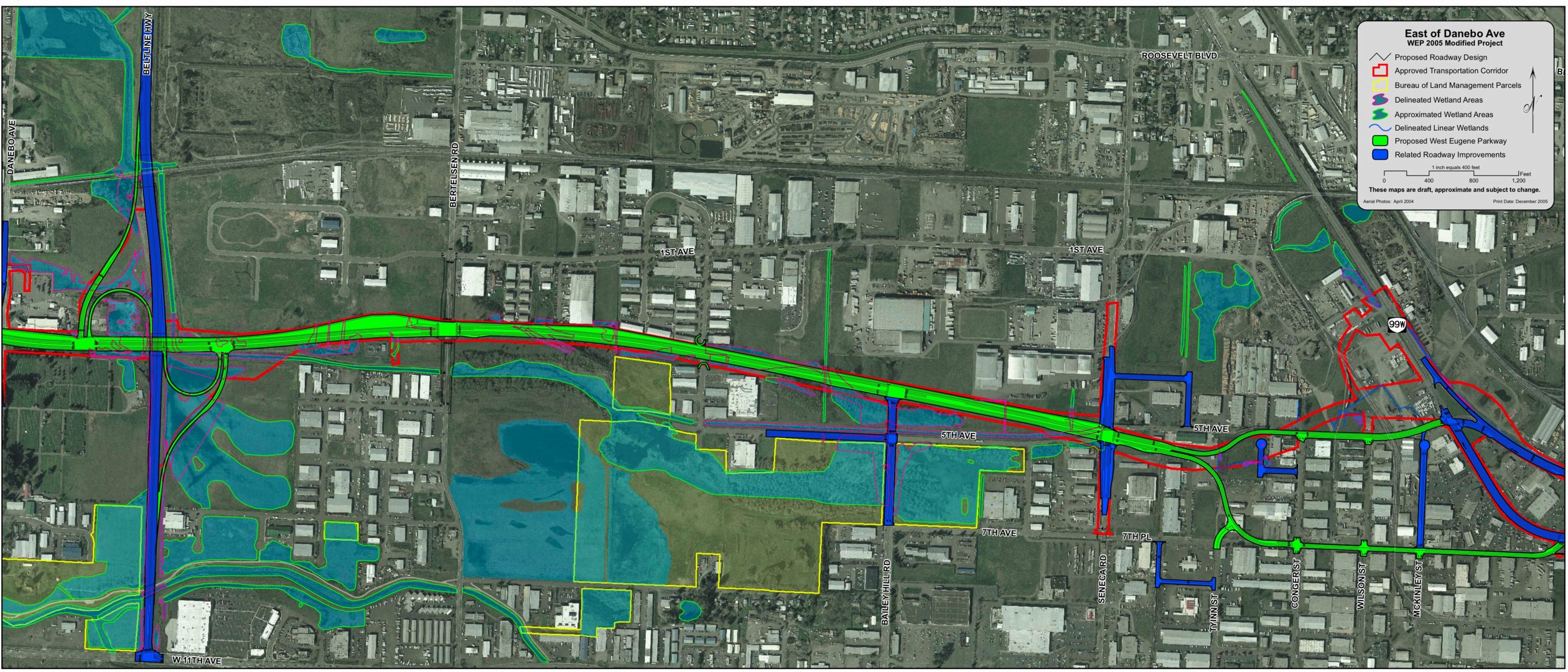
WEP East of Danebo (2005)
This map from ODOT's website shows the WEP from Danebo (far left of map) to Highway 99. The WEP is in green, and related road widenings are in blue (except ODOT's contractors forgot to include the Bertelsen widening in blue).