Hidden History of the WEP: 1951 to 2008
1951: Roosevelt Freeway first proposed on long term highway plans
1959: Roosevelt Freeway included on 1959 regional development plan
1961: Eugene voters pass charter amengment requiring public vote before freeway planning could be done in Eugene
1964: Eugene voters repeal freeway charter amendment
1967: Eugene-Springfield Area Transportation Study recommends new highways including Roosevelt Freeway, Skinner's Butte Freeway, Beltline through South Hills to LCC
1972: Eugene voters amend City Charter, again, to require city-wide vote on future freeways, I-105 completed to 6th and 7th Avenues (after being stalled at First for years), Roosevelt Freeway canceled
1973: Oregon Bill 100 passed by Legislature, Urban Growth Boundary and Land Use planning systems created
1978: T-2000 transportation plan includes early version of WEP, Roosevelt Freeway not included, four options studied, including a "6th / 7th" expressway and a "Whiteaker Bypass"
1985: West Eugene Parkway EIS process starts, purpose and need written, scoping of alternatives performed, first Draft EIS published
1986: Supplemental Draft EIS, City Council endorses WEP, citizen's advisory vote praises WEP
1990: Final EIS and Record of Decision for WEP
1996: ROD withdrawn a month after Save Our ecoSystems (SOS) federal lawsuit, FHWA declines to defend project in court
1997: second SDEIS published, public hearing on SDEIS. Study focused on "Modified Project," a new alignment that stays north of the railroad tracks for the westernmost part of the porkway to supposedly reduce destruction of endangered species habitat
1999: FHWA illegally removes Section 4(f) protection for BLM lands, keeps decision secret
2000: State gas tax for roads rejected by 8 to 1, Supplemental Final EIS stalled due to segmentation concerns
June 2001: intergovernmental West Eugene Charette picks No Build
June 2001 consensus from the City of Eugene, Lane County,
ODOT, Federal Highway Administration and the BLM to select "No
Build" Then Mayor Jim Torrey, County Commissioner Bobby Green and Oregon Transportation Commissioner Randy Pape all agreed that the WEP could not be built at this meeting, although they prefer to pretend that this consensus did not happen.
November 2001: City wide advisory vote recommends WEP 51-49.
2002: ODOT continues WEP study and purchases more property for the porkway despite privately admitting the highway would not prevail in Federal court and the money was not there.
2002: local governments change regional transportation plans to accommodate more of WEP, a few confused anti-WEP activists promote worse version of WEP (designed by architecture firm Crandall Arambula)
2003: EIS bogged down in bureaucracy and goes nowhere, ODOT scopes several new designs for WEP without public notice or participation by "cooperating agencies"
2004: Kitty Piercy elected Mayor on anti-WEP platform, FHWA approves "re-evaluation" of EIS, outgoing Mayor Torrey changes transportation plans to include more of the WEP
2005: new design for WEP unveiled that was rejected in 1985, City Council removes support for WEP but holds on to highway reservations and keeps agreement with ODOT to maintain part of the road
2006: collaboration process started with Osprey Group (highway consultants), FHWA, ODOT and City continue to move Final EIS toward conclusion, federal lawsuits being prepared, the money is still not there, ODOT finally agrees to give up WEP.
The 2006 decision to cancel the WEP Supplemental Environmental Impact Statement was made by Federal Highway Administration, not by the City of Eugene
2007: No Build formally selected by Federal Highway Administration, West Eugene Collaborative created to find a solution while ignoring the WETLANDS alternative
2008: West Eugene Collaborative publishes a map for West Eugene that includes building half of the West Eugene Parkway. Under criticism, WEC withdraws "half WEP." WEC's final report recommends $250 million West 11th widening, report ignored outside of the WEC group after a token mention in the newspaper.
1951 to 1972: Roosevelt Freeway
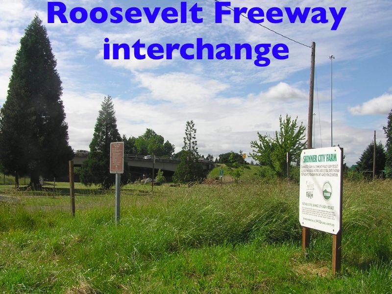
The ancestor of the WEP was the Roosevelt Freeway, an interstate highway proposed in the 1950s through the Whiteaker and Bethel neighborhoods. This highway was extremely controversial, especially after Interstate 105 crossed the Willamette river, tearing out part of the Whiteaker neighborhood. I-105 was originally planned to slice through south Eugene along Amazon Creek to connect with the 30th Street Expressway. The freeway revolts of the 1960s succeeded in stopping this boondoggle, and forced the highway department to terminate I-105 at 6th and 7th Streets.
www.ylekot.com/orehwys/i-105.html
I-105 was created as part of the Interstate System in 1956. The First segment between Laura & Q Streets in Springfield and Coburg Road in Eugene was built in 1960, the same time I-5 was built between Albany and Eugene. I-105 is marked only on the portion of the Eugene-Springfield Highway #227 west of I-5.
The segment between Coburg Road and Delta Highway in Eugene was built in 1960, but did not open until 1966 with the completion of Delta Highway by Lane County. Delta Highway was part of a freeway system constructed by Lane County in the late 1960 that included the Belt Line Highway #69. The Belt Line was swapped with the state for jurisdiction over River Road which was Junction City-Eugene Highway #223.
In 1968, the “Washington-Jefferson Street Bridge” was opened over the Willamette River with temporary ramps exiting at First Street while the City of Eugene and the State wrangled over the final design of the last segment of I-105 between First and Seventh Streets. Just north of First Street is an overpass for the proposed but cancelled Roosevelt Freeway which was to be the extension of OR 126 and the Florence-Eugene Highway #62.
In 1972, OR 126 was added to I-105 with the decommissioning of OR 126. This coincided with the completion of the Springfield portions of the Eugene-Springfield Highway #227 to the McKenzie Highway #15 in 1971.
In 1973, the final portion of I-105 was completed between First and Seventh Streets as an Overhead with a park underneath. This includes a covered basketball court under a portion of the freeway.http://www.kurumi.com/roads/3di/i105.html
3.49 miles [5.6 kilometers] [1]; runs northwest from the I-5/OR 126 interchange in Eugene. The city of Eugene reports I-105 being completed in 1961, the same time as I-5 in the area. [7] But the state DOT says I-105 was completed in 1969. [8] Or 1970. [9]
Sources
7. City of Eugene [Ore.] Historic Preservation Program. "Transportation and Communication." www.ci.eugene.or.us/PDD/Planning/eugenehistoric/eugenemodernism/02%20transportation.pdf (31 Aug. 2003)
8. Oregon Department of Transportation. "Road User Fee Task Force History." http://www.odot.state.or.us/ruftf/history.html (28 Sept. 2003)
9. Oregon Department of Transportation. "A chronological history of ODOT: 1899 to 1993." http://www.odot.state.or.us/ssbpublic/bss/rmds/history/~chron.htm (12 March 2004)
“Oregon’s rapid population and economic growth between 1985 and 2000 led to proposals for new freeways to meet traffic demands and reduce congestion. Proposed projects included the Mount Hood Parkway, the Sunrise Corridor and the Western Bypass in the Portland area and the West Eugene Parkway in Eugene. For a variety of reasons including funding constraints, environmental concerns and citizen opposition, none of the projects was constructed.”
– Atlas of Oregon, p. 104
see www.cfst.org/articles/STIP_Sunrise_Comments.html and www.cfst.org/articles/TopTenReasonsNotSunriseFreeway.html
Mt. Hood Parkway was a proposed connection between I-84 and US 26. The Sunrise Freeway is a proposed expressway from Clackamas (I-205) to Boring (US 26) outside the Portland UGB (it is still being pushed as a core part of the recent UGB expansion around Damascus). The Western Bypass would have run from I-5 south of I-205 to the Columbia River, where it would have connected to I-5 north of Vancouver, WA. These roads would have been parts of a de facto Portland Outer Beltway.
Myth: Oregon's planning laws hinder development of highways and other large public facilities.
Reality: From 1979 to 1988, Oregon's Highway Division successfully completed 146 major transportation projects. Since Oregon's planning program began (in 1973), only two large project proposals have failed: the Mt. Hood Freeway (east of Portland) and the Roosevelt Freeway (in Eugene). A 1988 study by a multi-agency committee found “the overall record of siting public facilities in Oregon to be good – probably much better than that found in other states.”
www.uoregon.edu/~pppm/landuse/myths.html
Department of Land Conservation and Development DLCD, 1992
WEP early versions
[excerpt]
West Eugene Parkway
Supplemental Needs Analysis
Lane Council of Governments
for the City of Eugene
and Oregon Department of Transportation
September 1994
A. History
As the Eugene community grew from 35, 900 population in 1950 to 117,000 in 1993, development has continued to expand westward in a carefully planned (sic) manner. Annexation history shows that Eugene expanded its boundaries west from Chambers Street to Bailey Hill Road during the 1940's, from Bailey Hill to Bertelsen Road in the 1950's, from Bertelsen to Terry Street in the 1960's, and from Terry to Greenhill Road in the 1980s. Accompanying those boundary changes were extension of key urban level services and westward expansion of industrial zoning. Residential development continued in the Bethel-Danebo neighborhood and in the Churchill High School region in southwest Eugene. The current urban growth boundary (UGB) extends west to Greenhill Road and southwest into the Willow Creek drainage basin. The west Eugene region represents the City's major area of existing and future industrial use.
The need for an east-west thoroughfare dates back to at least 1951 when the early concept for a Franklin Boulevard connector to Highway 126 at Greenhill Road was contemplated. All three Eugene comprehensive land use plans [1959 Development Plan (1959), 1990 Plan (1972), and the Metropolitan Plan (1987)] have incorporated an east-west limited access facility through the west Eugene region. All three comprehensive land use plans have increased the industrial and commercial designations further westward.
By the early 1970s, planning for the Roosevelt Freeway had been completed and some right-of-way had been purchased. Due to changing community awareness and attitudes, the adoption of the T-2000 Plan in 1978 replaced the Roosevelt Freeway with a new corridor in the alignment of 6th and 7th Avenues. Comprehensive transportation planning, environmental impact analysis, highway design, right-of-way purchase, and construction can take 10-15 years for an urban project of the Parkway's magnitude. Since th eupdate to T-2000 in 1978, it has taken 15 years to get to the wetland permit phase of the Parkway project. Interim improvements to W. 11th Avenue and other facilities have to temporarily mitigate traffic growth problems during the past two decades, but the capacity of existing facilities is projected to be exceeded during the next two decades. The Parkway will be needed during that period to avoid level of service F (gridlock) on W. 11th Avenue.
[Note: the 1990 Final EIS predicted LOS F on West 11th by the year 1996, which was an exaggerated claim.]
Transportation Plans [1960 Highway Study for year 1980-85, Eugene-Springfield Area Transportation Study Interim Report (E-SATS) in 1967, and the transportation plans mentioned previously] have all identified a need for a limited access facility serving west Eugene. The early plans extended I-105 across the Willamette River to connect with the Roosevelt alignment through west Eugene, but construction of the Valley River Center in the late 1960s obstructed that route. The E-SATS (1967 study) selected corridor extended from Interstate 5 along the south bank of the Willamette River through downtown and through the Whiteaker neighborhood following the "Roosevelt Freeway" route through west Eugene. Based on E-SATS, the state bought rights-of-way for this facility. Community opposition to negative impacts on the Willamette River Greenway and the Whiteaker and Roosevelt neighborhoods resulted in changes to this route in the late 1960s and early 1970's. By the time T-2000 was adopted in 1978, the Roosevelt corridor was replaced by a combination of 6th-7th Avenue improvements and an extension of the West Eugene Parkway through the west Eugene industrial area. TransPlan reflects the Parkway route with justification of its need for improved access, economic development, level of service needs, operational needs at intersections, truck traffic and safety reasons.
Note: the 2005 "Couplet" alternative would complicate access to a large area of the industrial zone, would cause as much economic displacement as development, make some traffic congestion issues worse, do nothing to fix deficient geometry at numerous existing intersections, complicate truck access to numerous industrial zone businesses, and further clog dangerous areas on Oregon 126 (across the lake), 6th and 7th Avenues, and west 11th intersections with north-south feeder roads. ....
The alternatives for a route for the east-west facility have changed from a Roosevelt route to a 6th - 7th/Parkway route over the past 25 years. The T-2000 and TransPlan processes examined "no build" alternatives and impacts on existing facilities without future highway improvements ...
D. Eugene Zoning (c. 1948)
The first major comprehensive zoning for the City of Eugene was adopted in 1948. The City's major industrial zone was located along the W. 6th an W. 7th Avenues corridor, and industrial zoning extended westward to City View, approximately where Highway 99 curves northwesterly at the "Big Y" intersection.
E. State Origin and Destination Study (1951)
The Oregon State Highway Department completed a 1951 origin and destination study which recommended a four lane facility to connect Franklin Boulevard with Highway 126 west of Greenhill Road. This facility was to be located north of downtown Eugene, through the Whiteaker neighborhood, and through the Bethel-Danebo neighborhood north of the Coos Bay Branch of the Southern Pacific Railroad to Highway 126 at Oak Hill on the western fringe of the metropolitan region.
F. West Eugene Rezoning (c. 1954)
In 1954, a major annexation in the west Eugene region occurred and much of that area was zoned for industrial use. This annexation and rezoning extended the City's industrial base west along the Coos Bay Branch of the Southern Pacific Railroad to the west of Bertelsen Road. Heavy industrial zoning extended west to Bailey Hill Road in the territory between the railroad and W. 11th Avenue. Light industrial zoning was extended westward along W. 11th Avenue to Beltline Road. This zoning concentrated Eugene's industrial zoning along the W. 11th and the 6th-7th/Highway 99 corridors.
G. Development Plan, Eugene-Springfield Metropolitan Region (1959)
This 1959 Plan was prepared by the Central Lane Planning Commission (predecessor to LCOG) for Lane County, the Cities of Eugene, Springfield, and Junction City, Eugene Water & Electric Board, Eugene School District No. 4, Springfield School District No. 19, and Willamalane Park & Recreation District. It was the first comprehensive land use plan for the metropolitan region. Prepared when the metropolitan region's population was estimated to be 87,955, this plan contained maps of existing uses, future uses, and existing and future major public facilities, including streets and roads. (Figure No. 3).
On the Central Eugene, Willakenzie, Danebo-Bethel and River Road, and Fern Ridge Planning Areas "Future Development Plan" maps ... the "Roosevelt Freeway" was proposed as a major east-west expressway. It was planned to begin at Coburg Road and funnel traffic from south Eugene, Franklin Boulevard, Coburg Road, and the then planned I-105 westward between downtown Eugnee and Skinner Butte Park through the Whiteaker (with an interchange with the planned Northwest Expressway) and Roosevelt (with an interchange planned at Highway 99) neighborhoods, along the south side of the Danebo-Bethel neighborhood and north of the Coos Bay Branch of the Southern Pacific Railroad (with an interchange with the planned Belt Line Expressway), and to connect with an interchange with Highway 126 atop Oak Hill on the western edge of the metropolitan region. ....
H. Highway Study - A Research Study of Traffic Patterns and Highway Needs for 1960 (1961)
Following the 1959 Development Plan was a more detailed study of metropolitan traffic needs. Information from preceding traffic studies was combined with projected 20-25 year future traffic needs to the years 1980-85 using a synthesized computer gravity model. However, this study was made immediately obsolete by the passage of the 1962 Federal Highway Act which required that all expenditures for highways in urbanized areas over 50,000 population be based on a cooperative, comprehensive, and continuing transportation planning study. The 1961 study did not meet these so-called "3C" requirements so the Eugene-Springfield Area Transportation Study (E-SATS) was initiated in 1963. By 1964 there were 127,500 people living in the metropolitan area.
J. Eugene's Freeway Charter Amendment (1961 and repealed 1964)
In 1961, Eugene voters adopted a City Charter provision which required a vote of the electors before freeway planning could be undertaken by the City. The 1961 Charter provision was repealed by the voters in 1964.
K. Eugene-Springfield Area Transportation Study (E-SATS), Interim Report (1967)
This study was never officially adopted by Lane County or the Cities of Eugnee and Sprignfield. It was adopted by the LCOG Board, the Governor's designated Metropolitan Planning Organization (MPO), to allow the continuation of federal highway and transit funds to flow to this region. By the 1960's, citizen protests over freeway projects had spread from major metropolitan centers to Eugene. Concern over impacts of automobiles and traffic on neighborhoods, air quality, and noise prompted protest, picketing and negative testimony before local elected officials.
E-SATS contained a number of freeway projects, including the Skinner's Butte Freeway and the Roosevelt Freeway. Those projects were described as follows:
Project #38, Skinner's Butte Freeway, "Acting as the northerly portion of the inner loop, the Skinner's Butte Freeway will serve traffic wishing to bypass the Eugene Central Business District.