West of Danebo options - 1997 and 2005
| West of Danebo (the BLM impacts, most of them) |
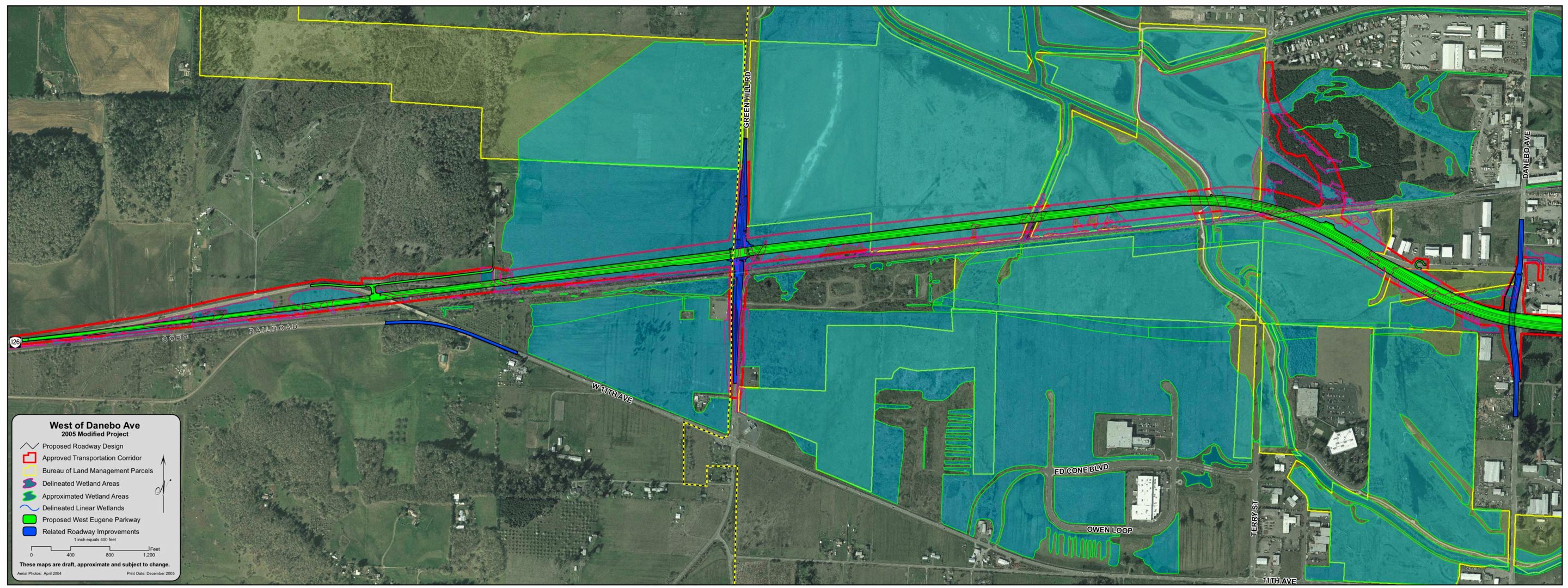
The "Modified Project" is the version in the 1997 Supplemental Draft EIS. The 2005 version of the WEP is essentially the same as the 1997 version west of Beltline, although the Terry Street Extended connector has been removed (which reduces a little bit the cost and complexity of the project). The functionality of the Terry Street / WEP intersection is apparently going to be met via continuing to keep the Beltline / Roosevelt intersection -- the Beltline Phase 3 project (part of the 1995 approval of the widening of Beltline from Highway 99 to West 11th) included a disconnection of Roosevelt from Beltline (grade separation, no ramps) similar to the Royal Avenue separation from Beltline.
This re-inclusion of a Beltline / Roosevelt traffic connection shows that the WETLANDS alternative makes more sense than the WEP for northwest Eugene traffic -- motorists in the Terry Street area who wish to drive toward downtown would have to get onto Roosevelt to access the WEP (via the zig-zag on Beltline to the WEP interchange). A more direct route for this direction would merely be to stay on Roosevelt to Highway 99 and then southbound on 99, it would be about the same travel time, and possibly shorter. This travel on the WETLANDS alternative (Terry - Roosevelt - 99) would also have fewer traffic lights than Terry Street to Roosevelt to Beltline to WEP and through the WEP "Couplet." to 99.
| 2005
Approved Project a new version not in the 1990 "Final" EIS nor in the 1997 Supplemental Draft EIS |
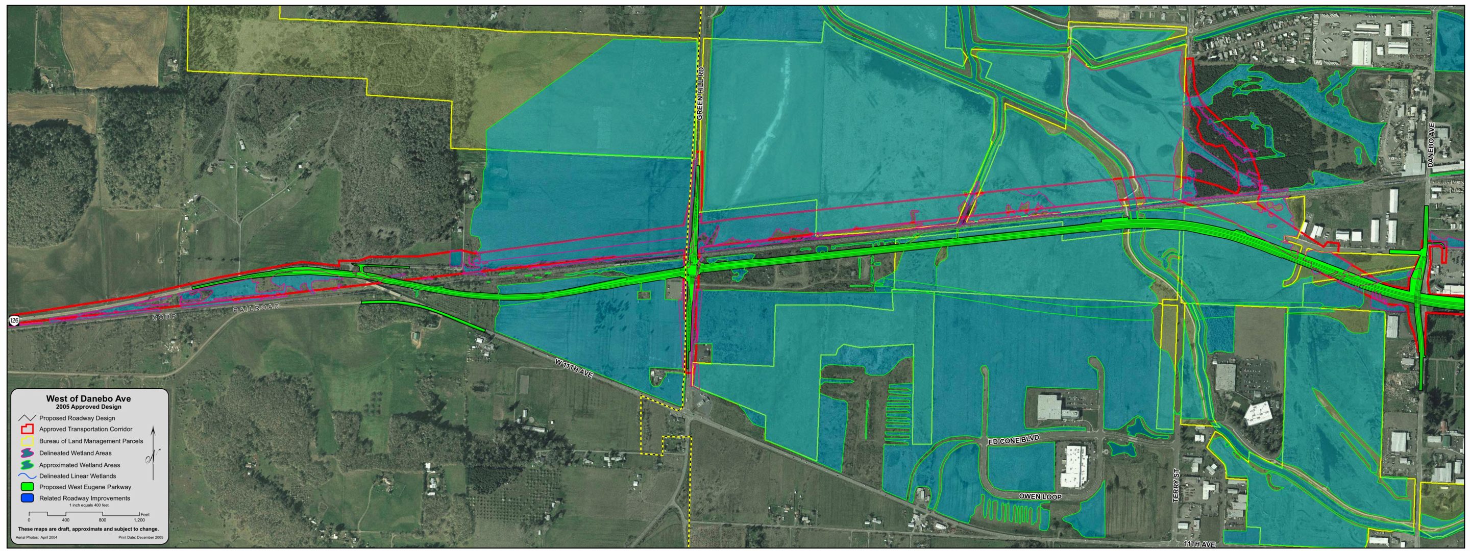
The "Approved Project" was the WEP version approved in the 1990 Final Environmental Impact Statement. The 1997 Supplemental Draft EIS compared a "Modified" project north of the railroad track west of Amazon Creek with the Approved Project south of the tracks. It may seem like a minor point to most people, but this "2005 Approved Project" shown by ODOT (at their October 2005 presentation to the Eugene City Council) is NOT the same "Approve Project" that was approved in a 1990 "Record of Decision" and then withdrawn in 1996 after a federal lawsuit was filed. The "real" Approved Project included a direct connection between West 11th Avenue (west of Green Hill Road, east of the railroad bridge) and the WEP. The point for rehashing this obscure history is that ODOT is slowly, subtly rewriting the history of the project, spending money to create yet another straw-man option to pretend that their new version is somehow more acceptable than previous failed efforts.
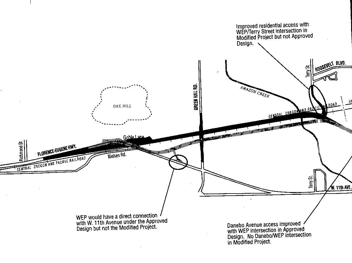
from the 1997 Supplemental Draft EIS
the dark line is the 1997 Modified Project, the grey line is the 1990 Approved
Project
this excerpt from the map shows how the Approved Project included a direct connection
to West 11th, and would make use of the existing 126 bridge over the railroad
tracks
why is ODOT wasting time and money redesigning a failed option that was officially withdrawn in 1996, or is ODOT incompetent and cannot keep track of their past actions (even though this route design is easily available from the 1990 Final EIS and 1997 SDEIS)